วันพุธที่ 24 กุมภาพันธ์ พ.ศ. 2553

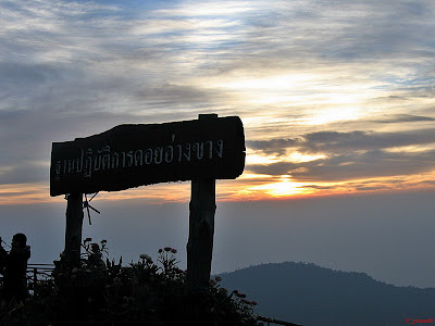
Doi Inthanon National Park - Land's End


One of the most popular northern destinations that no visitor wants to miss is the National Park on Doi Inthanon, Thailand's highest peak. It was formerly known as 'Aang Ka Luang'. This name came from several elements : its huge raven-shaped rock formation and the large lake which provided a year-round supply of water. Later the area was re-named Doi Inthanon after the remains of Chao Intha‑
Witchayanont, a ruler of Chiang Mai, were permanently relocated there.
Since Doi Inthanon is 2,565 meters above the sea level, its climate is moderate all year round. January however is the coldest month, with temperatures averaging between 5° Celsius to minus zero.
Wild plant species indigenous to Doi Inthanon are considered invaluable to the National Park. These comprise montane


forests, pine forests, dry dipterocarpaceae forests and evergreen forests. Other plants in Doi Inthanon National Park that would yield good economic value include teak, Malabar ironwood, pine, Siamese sal, hiang
(Dipterocarpus obtusifolia), ironwood, Burmese ebony, laurel and makhaa. In addition, there are many different species of orchids such as the Vanda Coerulea, Rhyn gigantea (red) and Paphiopedilum. These, together with the wild roses that grow abundantly all make Doi Inthanon a truly colorful paradise.


Visitors to Doi Inthanon finds them­selves caught up with the rare experience of being so close to Mother Nature with its mild weather, the beautiful flowers that dot the landscape, the birds in the air, the village lifestyle of the hill tribes, and most of all the beautiful mountain landscape.


How to get there: By car, leave Chiang Mai Municipality on State Highway #108 (Chiang Mai - Hawd) through Hang Dong and San Pa Tong districts to Chom Thong district. At approximately two kilometers before Chom Thong district, turn right into Provincial Highway #1009 (Chom Thong -Inthanon). Stay on this stretch for another eight kilometers before you arrive at the Doi Inthanon National Park.

Huai Nam Dang National Park - The beautiful sea of mists.


Huai Nam Dang National Park in the Pai district of Mae Hong Sorn is among Thailand's most popular tourist destinations. This 44,800-acre National Park in Chiang Dao Range is covered in thick forests and rolling hills, offering vital watersheds that contribute to its year-round mild weather. It is attractive because the park offers many vantage locations where visitors can take in its awesome beauty - the highlight of which must be the enthralling sea of mists at Huai Nam Dang Vantage Point, known otherwise as Doi -Kew Lom Vantage Point. The experience is especially breath-taking if one catches it in the early morning as the sun creeps up from behind the mist. Apart from the Doi Kew Lom Vantage Point, Pong Deuard Hot Spring and the Pong Deuard Nature Study Trail are two other attractions of the National Park that are equally worth checking out.


The National Park provides two choices of accommodation, one in the neighborhood of the Office of the National Park and the other in Pong Deuard which has a spa facility. Those who want to be close to nature can opt to camp overnight at the sites assigned by the National Park authorities. They are also able to help with providing food, beddings and such. Prior reservations are required.
How to get there: On Highway #107 (Chiang Mai - Fang), turn left at Mae Malai Market Intersection. Then, stay on Highway #1095 (Mae Malai - Pai) until kilometer stone 65. Take another right; Huai Nam Dang National Park Office is approximately six kilometers away.

Doi Mae Sloang = Enjoy fine tea and sakura blossoms


Doi Mae Sloang in Tambon Mae Sloang Nawk, Mae Fah Luang district of Chiang Rai province is the site of Santikiri village, known formerly as Baan Mae Sloang Nawk. This is a hamlet of settlers from the 93" Division who fled the then Burma into Thailand. In 1961, members of two battalions relocated their settlements. The 3" battalion settled in Fang district in Chiang Mai, while those from the 5th battalion chose Mae Sloang Nawk.


From December until February, visitors to Doi Mae Sloang will be greeted by the pinkish white sakura blossoms that grow abundantly on the mountain slopes. This is the tiniest of sakura blossoms and it is very rare in Thailand since it thrives only in very cold weather. Another attraction atop the mountain is the Phra Thart Chedi Sri Nagarindra Sadhitmaha Santikiri. This pagoda, whose architecture is close to that of the Lanna style, was built as a dedication to the late Princess Mother. Seen from afar, and especially in the evening, the pagoda stands out distinctly - adding to the overallbeauty and elegance of the mountains.


The fact that Doi Mae Sloang is located 1,200 meters above the sea level gives it two distinct characteristics as an attractive destination. From the mountain top, one can enjoy the panoramic view of the surrounding mountains - altogether a wondrously beautiful landscape. Also, with the altitude, the area enjoys an all-year-round mild weather. This makes it ideal for the growing of tea, and as a result, there many tea plantations where the local people work. Ulong tea, famous for its smooth fragrant taste is grown here. It makes an excellent gift and is available from practically every shop in the village.


How to get there: By car, follow the Chiang Rai - Mae Chan Route for 30 kilometers. From Mae Chan district, drive another kilometer, then turn left and continue the drive for 12 more kilometers to arrive at the Hill Tribesmen Welfare Development Center. This center was set up to help the hill tribes develop their skill in silverware making. Eleven kilometers from the Center is the Yao Doi Pha Deua Village, a scenic look-out point and where hill-tribe handicrafts are on sale. From Baan Yao, the road takes you to Baan I-Kaw. Turn right at the intersection for Terdtai Village, followed by another left turn into a new direction; Doi Mae Sloang is 18 kilometers away on this route. That makes the entire trip from Chiang Rai to Doi Mae Sloang a 42-kilometer ride.

Ang Khang Royal Agricultural Project - Floral Fairs


One of His Majesty the King's initiatives, the Ang khang Royal Agricultural Center was set up initially to promote alternative crop planting in an area that was once dominatedby illegal poppy plantations. The initiative was a result of Their Majesties the King and Queen's visit to Phak Fai in Fang district of Chiang Mai.


At Ang Khang, they saw the people of the Museu Tribe, who at the time still kept a long tuft of hair, were clad in black and commonly sported a pouch. They learnt also that the impoverished people made a living from planting poppy. Such cultivations were fast depleting forest watersheds and other resources, which would have severe detrimen­tal results on the country's ecological system. Hence in 1968, His Majesty purchased the land and the farms in some parts of Doi Ang Khang with his personal fund and set up the Ang Khang Royal Agricultural Station to study into the possibility of alternative crop planting, such as vegetables that thrive well in temperate climate.


Across the 6,400-acre of land, the Ang Khang Royal Agricultural Center boasts more than 12 types of fruit trees, 60 types of vegetables, and 20 varieties of floral species that grow in temperate climate. These include among others, broccoli, iceberg lettuce, phak hwarn (Melientha suavis Pierre), dryas, the remarkable thousand-year roses (rhododendron arboretum Smith), lilies and tulips. Ang Khang enjoys a pleasant climate all year round with temperature averaging 16 Celsius. It is therefore another destination popular with tourists.
How to get there: From Chiang Mai, take Highway #107, Chiang Mai - Fang Route. Turn left at the intersection at Tambon Mueang Ngai into Highway #1178 that takes you through Baan Arunotai and on to Ang Khang Royal Agricultural Center.

Pai - the land of mist


Pai is a small district north of Mae Hong Sorn that shares the border with Myanmar and today is a popular destination for both local and foreign tourists who seek the peace and natural beauty it offers.
It is named after the river that runs its course from Tanon Thongchai and Dan Lao Ranges through three districts in Mae Hong Sorn before joining the Salween in Myanmar. Hence one of most popular activities for tourists is white water rafting down the Pai River.


The white water rafting covers approxi­mately 50 kilometers in the waters with the grade of the rapids difficulty ranging from levels 1 - 4. The intensity reaches to level 5 in the rainy season when the river waters are particularly strong. Along the route, tourists will enjoy the scenic beauty and waterfalls where they may want to stop for a dip. Otherwise, exploring caves, and enjoying mud-bathing and cliff jumping could be some fun alternatives. The water, however, is ideal for cruises between June and February.


How to get there: From Chiang Mai, take Highway #108 along the Chiang Mai - Mae Sarieng - Mae Hong Sorn Route. Red bus and van services are available between 06.30 a.m. - 09.00 p.m. The trips take four and eight hours to Mae Sarieng and Pai district in Mae Hong Sorn respectively.


Doi Tung - The Mae Fah Luang Garden


Amidst the rolling hills of northern Thailand in Chiang Rai is a beautiful garden where flowers of temperate climate thrive. This is The Mae Fah Luang' Garden.
The original grounds of the garden,comprising some 4.8 acres of land was builtin 1982. Today,


it has expanded to twice its size and stands at 10 acres. The gardens are ablaze in color all year round as different types of flowers are grown here.
The 'Continuum', a sculpture of children standing on top of one another, graces the center of the garden. Other attractions include a rock garden featuring various collections of mountain pebbles, a water garden with a number of water plants, most notably lilies, and a garden dedicated to palm trees.
Located inside the compound of Doi Tung Pavilion, Mae Fah Luang is part of the Doi Tung Development Project in the ridge of Doi Nang Nawn Range 1,200 meters above the sea level. Visitors therefore can have a breathtaking view of the rolling hills from the garden as well. Little wonder therefore that it has become a prime attraction for those traveling along the Doi Tung Tourist Track.
How to get there: From downtown Chiang Rai, follow Highway #10 towards Mae Sai district through Mae Chan. Then, at kilometer stone 870 - 871, Baan San Kong, turn left into a new road (1149) on the way to Doi Tung.


Phu Kracreung: Abundant meadows, pine trees, cliffs and beautiful cascades


`Phu Kradeung' with its long winding roads and a steep climb has become the goal of many a young traveler, enthusiastic to conquer the challenge of a lifetime with a climb up Phu Kradeung. Hence in the winter months, thousands of these young tourists set out for Phu Kradeung, to enjoy not only the challenge of the climb but also to be captivated by the beauty of this mountain's surrounding landscape - grasslands, pine forests, cliffs and beautiful cascades
It is said that the peal of bells from Phu Kradeung is often heard on Buddhist Sabbaths, thus the name of the mountain 'Phu
Kradeung', with 'Phu', meaning mountain and 'Kradeung', meaning bell. Phu Kradeung therefore means the mountain of bells.
Phu Kradeung is a national park set on the flat elephant's ear (resembling a large leaf) on top of the mountain. Its Tourist Service Center (Wang Kwang) provides allthe essential services including accommoda­tion, food, advice and other forms ofassistance. Tourist sites are divided into those in the 'open forests' which include the pine forests where tourists are free to roam and explore, and the 'closed forests' where wildlife roams. Prior arrangement and approval from park authorities are required for any visit to this part of the forest.
How to get there: Drive from Muang Loei district on Highway #201 (Loei - Chumpare), turn right into Highway #2019. Once you arrive at Phu Kradeung district, drive on until you reach the Phu Kradeung Nation Park Office. Alternatively, from the south of the province, follow Highway #201 through Chumpare district of Khon Kae province.
Once in Leoi Province, drive through Baan Pha Nok Kao and continue for approximately eight kilometers. Then, turn left at the intersection into Highway #2019 and drive on until you reach Phu Kradeung National Park Office.
For buses that run from Muang Leoi district, take the Loei - Khon Kaen Bus. At the end of the bus service, change into a jitney at Baan Pha Nok Kao for Phu Kradeung National Park. The ride is 20 baht per person.

Phu Chee Fah - Wintry Winds and Sea of Mist


Under the open sky and above the sea of mist is 'Phu Chee Fah'. Its signature landmarks is its cliff that stretches into the Laos People's Democratic Republic as if it were a finger pointing eastwards, and itsgrass-covered mountain top that is abun­dantly dotted by bauhinia blossoms.


Located some 1,600 meters above the sea level, the 'Chiang Tawng' village is within sight while beyond it is the Mekong River which runs parallel to Doi Pha Mon. During the winter months, the first light of dawn creeps up from behind the clouds to unveil the valley below, which is shrouded in a veil of mist - creating such a beautiful sight that is unforgettable.
Phu Chee Fah is part of Doi Pha Mon Range in Phu Chee Fah Park. This is part of the expansive National Wildlife Sanctuary. The right section of Mae Ing Forest and Mae Ngao Forest in the neighborhood of Moo 9, Baan Rom Fah Thong and Moo 10 Baan Rom Fah Thai, Tambon Paw, Vieng Kan district of Chiang Rai province.
How to get there: Drive along Highway #1020 to Theung District and on to Highway #1155 until you arrive at the intersection. Here you make a right turn for Phu Chee Fah. Alternately, take the Chiang Rai -Theung bus to Theung district. Then, rent a car to Phu Chee Fah. Tourists can also take advantage of the #2402 van service that serves Chiang Rai and Baan Rom Fah Thai from Chiang Rai Bus Terminal. The bus leaves daily at 07.15 a.m. and 1.15 p.m.

Pang Oong in Mae Hong Sorn - Beautiful mists and mountain pines


The mountains beckon - as the road winds up through the twist and turns of contours. Soon the fields abundantly covered by the yellow Bua Tong or the Mexican flowers - carefully tended by the hill tribe villages - come into sight and you would have arrived at Mae Hong Sorn - one of Thailand's most charming tourist destinations in the north.
One of the most romantic places to be found in Mae Hong Sorn is 'Pang Oong' -a small village which is hardly accessible. The landscape boasts of rows and rows of pine trees through which the morning sun shines, throwing golden reflections upon the waters of the lake. Mists shroud the lake -adding to the surreal beauty of this place.
'Pang Oong' is where His Majesty the King's Patong 2 Royal Project is located, in an area called Baan Ruam Thai, Tambon Hmawk Chum Pay, Muang district, Mae Hong Sorn province. It was formerly an enclave of illegal poppy plantations. Today, the area is a tapestry of colors. A wide selection of flowers, vegetables and a host of herbal plants can be found as they thrive so well in these high terrains and under the temperate climate. Visitors will be enthralled at the richness of nature found here as they take in the landscape, visit the hill tribes and enjoy fresh coffee straight from the coffee plantations.
How to get there: From Mae Hong Sorn, follow the Mea Hong Sorn - Pang Mapha Route for approximately 10 kilometers. Then, take the left turn on the same route to Phu Klone passing Pha Seua Waterfall and Pang Tong Villa. At the signage on your left which reads 'Baan Ruam Thai', turn left and stay on the narrow road through Huai Makeua Som to Baan Ruam Thai or Pang Oong. The winding terrain up the steep mountains and the occasional fogs call for careful driving. Tourists are therefore recommended to travel by day. The village is served by a bus service from the bus stop in front of Mae Hong Sorn Market; buses leave for Pang Oong at 09.00 a.m. and 03.00 p.m. and from Pang Oong at 05.30 a.m. and 11.00 a.m. The trip takes approximately two hours.

Chakkayoe


In the distant past, courtship inThailand was confined initially to merit-making ceremonies. After the ceremonies, following merry-making activities, such as folk games, would provide opportunities for young men and women to spend time together. But their emotional relationships were still eyed by their elders. Today, young people enjoy greater opportunities to meet each other freely. As a result, Thai folk games which have been passed on from generation to generation are disappearing in the passage of time.Among them is the fun game of tug-of-war, known in Thai as Chakkayoe, which was popularly played during the Songkran Festival, the traditional Thai New Year. Players are grouped into twoteams that have equal numbers of people. Then a line is made on the ground, separating the two teams. The first person

of each team stretches his or her arms out to grasp the other side's hands firmly, while people behind them grasp the waist of the person in front of them, one by one, in a row.When the game starts, each team tries to pull the other until one side crosses the line. The team that crosses the line into the other side will lose. In some places, a rope is used for the two teams to pull. The winning team must be able to pull the other crossing the line into its side.

Visit to Koh Kred, Nonthaburi


Any visitor on a boat trip to Koh Kre would mostly impress with the simple way of life'along the-river - particularly Of the Mon community in the central area.
Weekends are perfect opportunity for tourists to enjoy a nostalgic atmosphere of simple way of life of the Mon community on Koh Kred. Many city dwellers like to get away from city hassle and take refuge on a boat trip to visit temples and to have a walkabouts buying local products, tasting local food at their leisure.
In addition to friendliness of the Koh Kred community people, another charm is in its location as a tourist destination where you could visit en route many other places of attraction within a day trip because of easily connecting routes. Along the way you could visit a number of cultural attraction sites such as Thai and Mon style pottery museum, bamboo and weed weaving handicraft center, and miniature sculpture center. If you like the succulent taste of Thai sweets you could definitely visit and taste as well as watching the demonstration of sweets making by venders on Koh Kred in Klong Bang Bua Thong. Many visitors return home with full stomach, and a handful of souvenirs.
Boat trip to Koh Kred is on service only on weekends. Visitors couldtravel to Kon Kred via several routes and means. By car from Bangkok, take the Chaengwatana express way to Pak Kred 5-prong intersection. Or you could travel on Chao Praya Express Boat.

Similan Islands - Beautiful Gems of the Andaman


Ranked one of the world's ten most beautiful-deep-water diving spots, the Similan group.of islands is paradise found for world divers, thanks to its wealth of cdral reefs,_ and a colorful myriad of marine


Phang-Nga, once dubbed 'Phang-Nga Fah Daeng', was a hardship town void of easy road access until it was discov­ered by Hollywood in 1984 when it was featured in the ninth James Bond movie 'The Man with the Golden Gun'. Phang­Nga Bay - Set in the Similan Islands, with its pristine forests, and wildlife - has indeed seen many changes. The movie certainly steered this beautiful and peaceful province into the limelight of tourism.Today Phang-Nga Bay, in particular the area around the Similan Islands where the Andaman joins the interna­tional waters of the Indian Ocean, is well-known for the beauty not only of its landscape but also-of its underwater world. It has been named by the American Skin-Diving Magazine as one of the world's ten most beautiful islands
Located approximately 60 kilometers from Phang-Nga Bay, the Similan Islands have been spared the dregs that plague the mainland. Hence, the sea water around the islands is so clear that the sun could shine through the water for long stretches along the shorelines. The waters are also blessed with rich coral reefs and marine vegetation and are home to a wide range of big and small marine life.It is not surprising therefore that world divers consider the Similan Islands a must to visit for the dive of a lifetime.
The period between the end of December and the middle of April is the best time for diving although March offers the best monsoon-free weather when the water is at its clearest.

The Kaeng Tana National Park


Ubon Ratchathani province


Located in Khong Chiam and Sirindhorn districts, Ubon Ratchathani province, Kaeng Tana is the 33` national park in Thailand. Since its vast area is bordered by three rivers, namely the Mekong, the Mun,and the Lam Dom Noi, the weather here is pleasant. In summer, it is not too hot, and in winter, it is not too cold. During the rainy season, rainwater flows freely into the three rivers. So this national park is one of the best places for relaxation all year round.
The word 'Tana' was derived from 'Tenia', which is an ancient Khmer word, meaning a natural fishing source. This source is a hole resembling a large or small cave under water where numerous fish stay in hiding.
Legend has it that Prince Chitrasen led an army to carry stones from the nearby Dong Hin Kong Forest to build a stone castle. The army depended on Kaeng Tenia, because the rapids were rich in food sources. In the early Rattanakosin era, a Thai army was posted at the Dong Hin Kong Forest Park. The army used Kaeng Tenia as a place to supply food to Thai troops, which were occupying Champasak province in Laos Later, the place was called Kaeng 'Tana', which is a variant of the word 'Tenia'.
One of major tourist attractions here and adjacent areas is Saphan Khwan, or hanging bridge, linking the Mun River with Don Tana. It is the longest hanging bridge across a river in Thailand. The structure is made of iron with large slings connecting all parts, and the floor is made of planks. Next is Lan Pha Phueng, comprising a sandstone platform and a 50-meter-long cliff. The cliff faces east and is the place to have the best view of a rising sun. Visitors may have a panoramic view of Laos from this area. Another attraction is Rak Sai waterfall, where water flows over a cliff along banyan roots on the bank of the Mun River. The flow of water resembles a curtain falling onto the rock ground. This area is best for taking short treks.

Naradhiwas-Rajanagarindra Road


Naradhiwas-Rajanagarindra Road was built initially to address the issues of Bangkok's plaguing floods and traffic congestion. More importantly its construction was a tribute to the late Princes Sister, HRH Princess Galyani Vadhana.

The construction project of Naradhiwas- I Rajanagarindra Road along Chongnonsi Canal was the result of the 4th Bangkok Development Plan, 1992 - 1996, in the quest for an effective solution to ease Bangkok's plaguing floods, clogging sewage systems and traffic congestion. But it was also planned as a tribute to the late Princess Sister, HRH Princess Galyani Vadhana. Therefore, royal permission was sought to name the road after her. Following the royal approval on December 1, 1996, the new road was officially called Naradhiwas-Rajanagarindra Road.
Starting from Surawongs Road, the 4-2 km Naradhiwas-Rajanagarindra Road has eight lanes and it cuts through several main roads including Silom, Sathorn, Chandr Thud Mai and Ratchadapisake and ends when it meets the Rama III Road. It is currently served by BTS Skytrain at the Chongnonsi Station and it will soon be served by the BRT Express Bus on the Surawongs - Ratchapreuk pilot route.
Within the neighborhood of Naradhiwas-Rajanagarindra Road are several important addresses such as the Belgian, Saudi Arabian, German, Myanmar and Singaporean embassies. Several large office complexes - which house the head offices of various conglomerates, are also located along this road. For those who love to shop, there are many choices to be found in the vicinity - including the trendy Soi Lalaisub, department stores and the Suan Lum Night Bazaar.
An interesting stop, worthy of a visit is where Naradhiwas-Rajanagarindra Soi 7 joins Soi Suan Plu. This is where the home of Thailand's 13th premier, MR Kukrit Pramoj. Is located. Today, it is a museum and is classified under Thailand's 'historical monuments of leading dignitaries' residences'. Stepping into the residence, one soon leaves the noise and busyness of the city behind as the grounds with its rich foliage beckon visitors with a peace and quiet that is hard to find in the heart of Bangkok. It promises a brief respite - far from the maddening crowd - if one happens to be in the vicinity of the Naradhiwas-Rajanagarindra Road.
For those in search of a good meal, many restaurants offering a wide selection of cuisine types - Thai, I-Sam, Chinese or Western as well as pubs - can be found along both sides of this road. Little wonder then that the Naradhiwas-Rajanagarindra Road is now one of the more popular places to hang out after work, for office workers and tourists alike.

Bang Lamphu


Bang Lamphu is the name of Bangkok's major trading center, which was very famous in the past. The name is derived from the lamphu trees that grew in abundance on the banks of the Chao Phraya River.

The roots of the lamphu tree spread along the ground. Fireflies that glow in the dark often come to stay in this tree. The flickering light of fireflies seems like light decorations at night time. So the community on the riverside of the Chao Phraya is called Bang Lamphu.
Since lamphu trees were so plentiful in this area, they created several occupations for local people. For instance, lamphu roots could be made into stoppers for bottles containing traditional medicine, liquor, fermented fish sauce, and wine. Later, the number of

Lamphu trees declined significantly. Only one lamphu tree still exists as the symbol of this area, in Santi Chai Prakan Park.
Khlong Bang Lamphu came into
existence when more canals were dug to expand Bangkok in 1783. This canal was used as a transportation route for trading by boat. Vegetables and fruit and other
products from the provinces were trans­ported on various types of boats for sale in this area. Moreover, Khlong Bang Lamphu was also the trading area for large and small boats, such as pratuns and sampans.
Development has led to the construction of many roads in the Bang Lamphu area. Among them is Khao San Road, which was the location of the palace of Princess Chalermkhet, the house of the Thepphasin acting troupe, and a major shop for incense sticks. Phra Sumen is a busy road in Bang Lamphu, as it is famous for men's wear. Tani Road, or known as Sip Sam Hang Road, consists of buildings constructed in the reign of King Rama IV, and all kinds of fashion accessories can be purchased there.
Bang Lumphu in the past was as important as shopping centers are today. It was also the location of many entertainment places, such as Mae Boonnark Theater on the bank of Khlong Bang Lamphu, li-ke (a popular form of theater) of the Horn Huan troupe, and Penang Theater.Bang Lamphu today is still a major trading center. Both older and younger generations may find their favorite products in this area.

moderntramway